


From Andratx to Banyalbufar

"Mallorca’s mountain chain runs almost continuously from Freu de Sa Dragonera to Cap de Formentor cape. Its northern side is one of the most beautiful landscapes on the island. Exuberant and very rough from Dragonera to Tuent, from there it is rockier and wild to the fantastic point of Cap de Formentor. The route through the foothills and cliffs of Sorrento and Amalfi can barely compete with the beauty of these first stretches.
Let’s guide our steps, then, from Andratx to the west, seeking Estellencs.
The path rises up Coma Freda, just behind La Font, at the foot of a hill crowned by mills. To the right we leave behind the small Possessió de Son Miquel estate and cross through some beautiful plantations of olive and carob trees. The fairly good path curves three times, overlooking Andratx Valley. Now at the top, to the left is a picturesque stream bed consisting of rocks, and the path the runs through the Coma Freda Valley, the latter consisting of terraced hills with olive and carob trees interspersed with some houses surrounded by prickly pears and orange trees underneath tall pine trees.
We cross the hollow which is protected by pine-covered hills. It forms a plain converted into harvested plots. We begin our descent, interrupted in the middle by a plaster factory called Gramola. Fan palms and reeds have made the reddish soil here theirs, sprinkled here and there with blocks of gypsum reaching the very road.
Descending a bit farther, we discover a unique image: voluminous mountains close off the valley on either side, some cabins in the distance and, at the end, in middle of the plain and not far from the sea, an almost perfectly conical hill. To the right, another valley opens up on whose slope on that side the path continues on very reddish soil towards the imposing Mola de s’Esclop.
Farther on, to the right, we come to some terraces where numerous fig trees grow beside a spring, Sa Font de ses Fontanelles. To the left, there is a broad pass through which the road runs alongside a stream called Torrent des Corral, leading to an impressive valley whose full extension we can only appreciate from the top of Sa Mola de s’Esclop. Exuberant mastics have taken over the free space between the large blocks of rock piled up seemingly without rhyme or reason. Just where a cave opens, we cross a stream bed which continues down the valley and we head along the spurs of some hills full of holes and caves. The view of the distant cove is fantastically wild as seen from the steep slope of this valley known as Sa Coma des Corral Fals. Mastics alternate with fan palms and piercing shrubs. The lower part of Coma, towards which the path winds down for a while, seems populated by fairly large pine trees.
A soft climb provides us access to Sa Coma dels Aljubs, a very abrupt, rocky bed traversed by a stream and on whose left side rises up the mountain called Moleta. This torrent, with stretches hidden by ancient mastics, defines the border between the municipalities of Andratx and Estellencs.
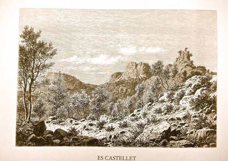
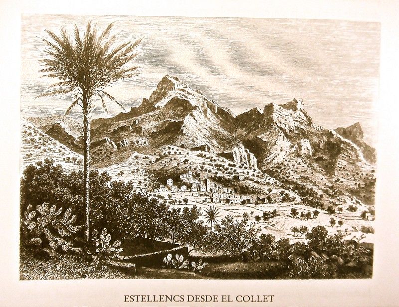
 We reach Puig des Castellet peak which overlooks the entire Estellencs Valley. A stepped path in very poor state begins the descent, and, where there are two curves lined by pine trees forming a monumental parasol, we stop to take in the view of the entire town.
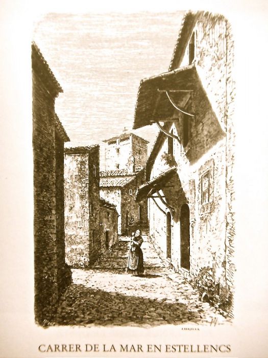
 Estellencs, one of the smallest towns on Mallorca, is happily found at the base of the mountain facing the sea. It has 562 inhabitants and 155 houses, 18 of which are uninhabited. Steep streets here, others with steps, some paved, others with cobblestones cross the uneven coasts up and down. The majority of houses consist of only one story, 57 have two, and only four have three. The houses are dark in color, not having been whitewashed. Their doors are primarily rectangular in shape, though some have rounded arches.
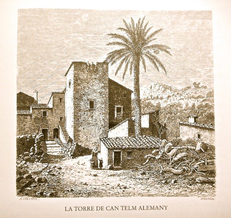
 The old Can Telm Alemany tower rises up 151 m above sea level and is only shorter than the beautiful palm tree growing at its side. It reminds us of those times when the Berbers threatened this peaceful settlement. The top part of the town is known as s’Arraval.
Estellencs is fairly rich in water. At the foot of the town are some terraces growing vegetables, almond trees and other fruit trees. Attached to a house is another tower called D’en Jeus, braced on the top part, with a tile roof and a small door at the base. Today its purpose is to communicate Estellencs with Andratx, something which would also be of great benefit to Banyalbufar.
Estellencs Port, as people insist on calling the nearby cove, merits a small excursion on our part.
Picturesque and curious is the image of the small creek falling over the terraces crowned by reddish layers of shiny sandstone which makes for excellent millstones and called here “pedres esmoladores”. The best are taken from behind a rock shaped like a fang, standing out amongst the others. On the other side of the creek is a spring, next to the terraces closest to the shaded beach.
 Once more on the road to Banyalbufar, we leave the Serral Blanc on the left and then the Es Millar house with its orange and palm trees. Bordering the valley, the path continues along the foot of terraces planted with olive trees up to the summit of Collet.
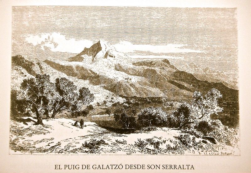
The road to Banyalbufar now climbs up to the heights, leaving a small branch to the right. The latter heads along a stream towards Putxet, a privileged spot overlooking neighboring Son Serralta and the more distant Puig de s’Hereu, seemingly arising out of the sea, and the Serra peaks dominated by Puig de Galatzó. Estellencs is now hidden by numerous nearby olive and carob trees. An elm and a hackberry grow here, and on the sundial decorating the spot we can read the inscription: “Nascor cum Sol oritur. Morior cum Sol moritur”.
 The house, with a “tafona” (flour mill) and “biga” (beam), also has a small spring which is often dry. The house is surrounded by almond trees. A path takes you to the neighboring Son Serralta, an old dark house with a majestic appearance and an arched doorway protected by arrow-slits. There was once a chapel, today in ruins. A walled-up staircase begins in the paved patio in the left corner. The house offers a splendid view of Puig de Galatzó and surrounding mountains, a view perhaps only exceeded by that from the higher up Son Serralta de Dalt.
No less beautiful is the view offered from the same road lined by terrace after terrace until the tall Verger Tower. The road continues through a hollow full of Holm oaks and then softly climbs shortly thereafter through a dense grove of pine trees over fan palms and shrubs, the blue of the sea serving as the background. We circle around the Font de sa Menta Valley on a slope of squalid pines with some carob trees on the opposite side. Here we find the Font de sa Menta house and the spring which leaks out of a rocky crevice. It continues through the depth of the valley, its left shore crumbling at the foot of a black poplar and a thicket of mastics.
A bit farther we come to another stream, fed also by two other springs. The first is small and deep, starting among some ferns of the variety called “maidenhair fern” at the base of a knotty myrtle. The second is much higher, springing up among reeds. Before us is the rough Verger Tower, crowned by some ledges which are falling off in bits. Behind us, we can see the rounded Puig de ses Cabres peak with the gapped profile of Dragonera in the background.
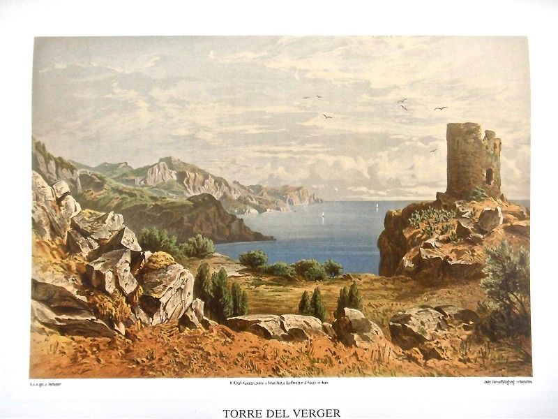 This place is heavenly, one of the prettiest on the island if not the most, I might add. The view from here is vast, on one side encompassing the entire coast until Dragonera’s craggy silhouette, and, on the other, all the sea to Cap Gros de Sóller cape. In truth, it is difficult to imagine a more harmonious and impressive landscape than the first described. Every time I’ve seen it, its prodigious beauty has moved me, as if recently discovering it again. So much so, that I finally made this unique place my own property.
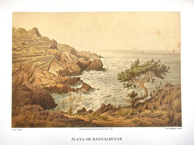
Banyalbufar has 461 inhabitants and 128 houses, 7 of which are uninhabited. It is thus much smaller than Estellencs, but more beautiful and cheerful due to its proximity to the sea, the latter’s blue surface seemingly endless to our eyes.
Almost in front of Baronía, on the same road, we find the small church in Banyalbufar, a suffragan of the Esporles parish, a town to which the one before us now was also once dependent. The original temple seems to have been built in 1417 and, like the current one which dates from 1690, was dedicated to the Birth of the Holy Virgin. The ruinous state of its main wall on the right side is the result of the 1841 earthquake. This led to it being demolished and rebuilt at the expense of Queen Isabel II through alms gathered from among the inhabitants, in particular from General Fernando Cotoner. The interior includes a vaulted ceiling whose arches rest on smooth columns with sculpted capitals which also support the heavy cornice. These pillars also separate the side chapels, three and three, with respective altars, as ancient as the main altar towards the back. In the arch of triumph we can see the date, 1690, presiding over the entrance to the choir above two chapels. In the sacristy is a beautiful chalice decorated with the Passion of Christ and the Holy Virgin. We can also read the inscription: “Banyalbufar 1565”.
 Buildings in the actual town of Banyalbufar are very close together, with 43 small, dark houses, consisting of one story and a half-point arch door. Between them are dense and picturesque plantations of prickly pears. At times, the presence of one or another majestic palm stands out. It’s curious to see that the cantilevers covering the door don’t hang forward like they do in Estellencs. Rather they go from either side. The house roofs are made of tile with planks underneath, also supported on wooden strips. The town’s small streets, excepting the road which crosses it entirely, are narrow, rough and stepped.
A pretty excursion takes you from Rafal de Planícia to the “mola” of the same name. Just above the last of the houses mentioned is a carefully tendered vineyard. The path surrounding it climbs up in a curve towards the Planícia house which has a “tafona” and two “bigues”. It’s found on the edge of the forest, next to an enormous stone block along with some nearby elm and almond trees. From here is an excellent panoramic view of the olive plantations at its feet, the nearby forest and the more distant Mola de s’Esclop. At the foot of the house, a path takes you to Puigpunyent which joins another one heading in the same direction but from Estellencs and crosses the Son Fortuny forest. We take this path for a while before reaching a picturesque grotto to take a steep path which climbs up to the Planícia forest.
The “mola’s” 932.87 meters offer a singular view. Below us are the Puigpunyent, Esporles and Valldemossa valleys and the entire plain, though Mola des Verger keeps the city of Palma out of our view. No less charming is the panoramic view of the coast with the promontories of Valldemossa, Foradada and Deià towers and Cap Gros de Sóller cape. On the other side is Puig de Galatzó, to the right of which rises up the majestic Mola de s’Esclop, its neighbor, Cap des Puntals with the forests of a Planícia, farther on, the valley of Estellencs and the lower foothills.
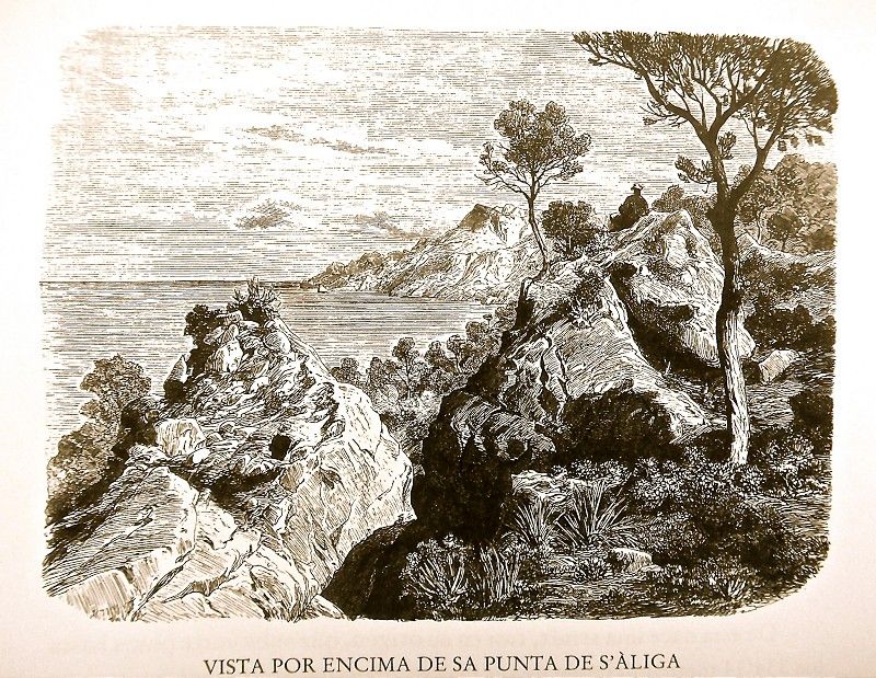 Now up on the peak overlooking s’Àliga, we can see the rough coast in perspective, offering an especially pretty view from here. The path later descends along a path made of slate though plagued by loose stones. Father along, between conglomerate walls, the path traverses a pine forest. We circle around the rocky Corral Fals escarpment, under which sheep often take shelter, and our eyes enjoy contemplating the whitish point of s’Àliga with its large prominent gaps, seemingly forming ominous teeth.
Passing by a tall grove of pines, we reach a fisherman’s house at Port des Canonge. Another, larger and whitewashed one has been recently built next to it, the waves breaking on the small beach. This peaceful place, with its red, sheer boats, is a corner as equally graceful as it is picturesque. From Port des Canong, a path borders along the shore, leading to Port de Valldemossa."
Archduke Ludwig Salvator of Austria.Las Baleares por la palabra y el grabado. Majorca: The island. Ed. Sa Nostra, Caja de Baleares. Palma de Mallorca. 1982.
Photos